
Kathu Waterfall Loop
Phuket's toughest jungle loop: a real recorded 14.5 km circuit from free-to-enter Kathu Waterfall up to the Phuwa Rattanakiri ridge and back — with GPS track, elevation profile, a halfway jungle cafe and live trail conditions.


Distance
11.8 km
Elevation gain
0 m
Time
≈ 3.2 hrs
Est. · be first to log a time
Route
loop
Surface
Jungle path & fire road
Best season
Jun – Nov (waterfall flowing)
Trail map
Approximate route shown. Always carry an offline map and water.
Trail markers
0No markers yet. Add a shelter, water source, hazard or junction to help others.
The Kathu Waterfall Loop is Phuket's most rewarding — and most demanding — jungle hike: a real, GPS-recorded 14.5 km circuit that starts and finishes at Kathu Waterfall (น้ำตกกะทู้) and climbs through thick rainforest to the Phuwa Rattanakiri ridge before dropping back down to the falls. Most visitors only climb the concrete steps to the first couple of tiers and turn back — this guide is about the whole loop: the route, the elevation, the halfway jungle cafe, the honest seasonal trade-off, and everything the other guides leave out.
Our numbers come from a real recorded track. Published distances for "the Kathu loop" range wildly (0.5–4.3 mi) because they all describe different walks. Ours is the complete ridge loop up to Phuwa Rattanakiri — longer and steeper than the short falls loop, which is why the stats above are bigger than the figures you'll see elsewhere.
Who the trail suits
The routes on Thailand Stuff are logged and used by everyone from hikers to mountain bikers, and this loop rewards each discipline differently:
- Hikers get the most out of it — a proper half-day jungle trek (about 14.5 km and ~624 m of climbing) taking in the waterfall, thick rainforest and the Phuwa Rattanakiri ridge.
- Trail runners will find a tough, technical long run; it's steep, rooty and slippery when wet, so pick a drier day and take care on the descents.
- Mountain bikers and enduro riders can link the old fire-road climbs toward Phuwa Rattanakiri, but expect hike-a-bike in places — treat it as an adventurous backcountry ride rather than a flow trail, and it grips far better in the drier months. (The halfway cafe is a well-known rider hangout — see below.)
Whatever your discipline, you can filter the leaderboard and log your own time by category further down the page. If you just want to see the waterfall with kids, skip the loop and take the stone staircase to the first two tiers instead (easy and family-friendly, about 45 minutes to 1.5 hours return).
The route and key landmarks
The loop begins at the Kathu Waterfall car park and quickly leaves the tourist steps behind, branching onto jungle trail and old fire road that climb steadily toward the ridge. In order:
- Trailhead and parking: free car and scooter parking at the falls (informal attendants; snack and water vendors at the entrance). The loop branches off the main staircase a short way up — follow the dirt trail rather than the concrete steps.
- The climb: a long, hot ascent through closed rainforest canopy on old fire road and single-track. Phone signal is poor under the trees, so carry an offline map or the GPS track.
- Halfway: Jun Jaow, the "enduro cafe": roughly halfway around, this rustic jungle cafe is a welcome refuel stop for simple Thai food, cold drinks and coffee, and is a well-known hangout for the enduro and mountain-bike crowd. It even has onsite camping, so you can split the loop over two days rather than rushing it. It's remote and informal, so don't count on it being open — carry enough water for the whole loop regardless.
- Phuwa Rattanakiri: the high point of the loop — a ridge and hillside monastery with big views back over Kathu and the west coast, and toward Kalim Bay on the extended variant.
- The descent and close: the trail drops back down to Kathu Waterfall where you started. Use the interactive map and the elevation profile above to see exactly where the steep sections are, and the community-logged times to plan your day — then log your own when you're done.
The waterfall at the start and finish
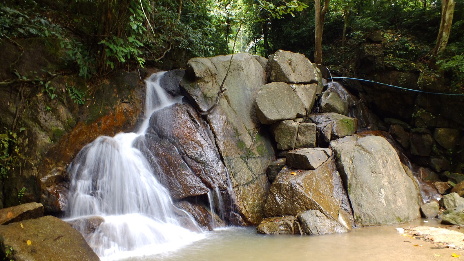
The loop begins and ends at Kathu Waterfall, a low series of jungle cascades over roughly four main tiers — not a single big drop (ignore the "130 m tall" figure some sites quote; that's the length of the staircase, not the height of the falls). Concrete steps reach the first two tiers, a dirt path the third, and a rock scramble the fourth. The pools are shallow drop pools for wading and cooling off rather than real swimming holes, and the falls only flow properly in the green season — so it's as much a start/finish landmark for the loop as a destination in itself.
Best time to hike the loop
Season is the single most important decision for this hike, and it cuts both ways:
- June to November (green/rainy season): the falls actually flow and the jungle is at its best — this is when the trip is worth it.
- December to April (dry season): the water drops to a thin trickle; the falls alone aren't worth a special trip, but the loop and the Phuwa Rattanakiri viewpoint still are (and it's the better, grippier time on wheels).
The catch is that peak water is also peak hazard. In heavy rain the trail turns genuinely slippery, stream crossings rise fast, and the upper sections can be dangerous. Check the live rain radar and forecast further down this page before you set out, start early for cooler air and full daylight, and don't commit to the full loop during or right after a downpour.
How to get to the trailhead
Kathu Waterfall sits in Kathu district, central Phuket, roughly halfway between Patong and Phuket Town on Soi Nam Tok Kathu (Waterfall Road), near the Loch Palm and Red Mountain golf courses.
- From Patong: about 20 minutes and 8 km by car or scooter (head toward Phuket Town, then turn onto Waterfall Road), or a short Grab ride.
- From Phuket Town: about 15–20 minutes and 12 km.
- From Karon, Kamala or Kathu itself: under 25 minutes.
Entrance fee hours and facilities
- Entrance fee: free. Unlike Bang Pae and Ton Sai waterfalls (inside Khao Phra Thaeo and charging a ~200 THB foreigner fee), Kathu is not inside a national park.
- Hours: it's an open natural area; hours are usually listed as roughly 8am to 6pm. Go early to beat the heat and the crowds.
- Facilities: car and scooter parking and drink/snack vendors at the trailhead, plus Jun Jaow (food, drinks and camping) about halfway round. Don't count on reliable toilets up the trail.
Safety and what to bring
- Footwear: grippy trail or approach shoes — the stone steps and roots are slick, especially when wet.
- Water and sun: carry more water than you think; the climb is hot and humid and you can't rely on the halfway cafe being open.
- Navigation: download an offline map or the GPS track, because the jungle canopy kills phone signal.
- Wildlife: macaque monkeys hang around near the falls — don't feed them and keep food secured. Snakes are possible in the jungle (make noise and wear closed shoes), and in wet-season rainforest you may meet mosquitoes and the odd leech, so long trousers and repellent help.
- Rain: re-check the radar and turn back if the stream is rising.
Kathu vs Bang Pae vs Ton Sai
Choosing a Phuket waterfall? Kathu is the free, close-to-Patong option with by far the best hiking. Bang Pae and Ton Sai (both in Khao Phra Thaeo, ~200 THB entry) are gentler and better for a short family walk you can combine with the Gibbon Rehabilitation Project. For a genuine trek or ride, Kathu wins.
Things to do near Kathu Waterfall
Easy to combine into a half-day: Phuket Wake Park (a short walk away), the Flying Hanuman zipline, the White Sitting Buddha, the historic Kathu Shrine (one of Phuket's oldest, central to the Vegetarian Festival), and the Phuket Mining Museum.
Waterfall photo by Nicolas Voitot (CC BY 3.0); other images are representative Phuket rainforest. Route from a GPS track recorded by Borja F1 and shared on Wikiloc.
Features
Good to know
Video

Thailand Stuff
Frequently asked questions
Conditions
Weather, surface and what to expect underfoot.
Is it wet right now?
Phuket's trails turn slick and muddy fast in the wet season. Check the live rain radar before you head out.
Times & leaderboards
Log your time on this trail and see how you compare.
No enduro times yet
Be the first to log a time on this trail.
Reviews
No comments yet. Be the first to share your experience.


